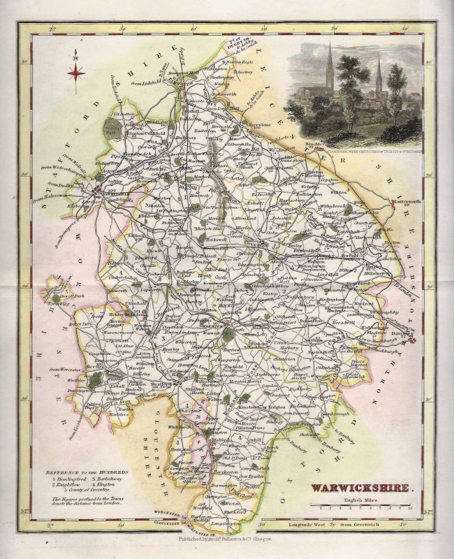
‘WARWICK SHIRE Drawn from an Accuatate Survey’ by Thomas Kitchin (ex Boswell atlas) c.1786
$33.59
$54.08
An attractive and neatly engraved 18th century map of Warwickshire which was engraved by Thomas Kitchin and published in Henry Boswell’s Antiquities of England & Wales* (London: A. Hogg, 1786-1798). Thomas Kitchin was one of the most eminent and prolific cartographers in the 18th Century producing many fine maps and atlases. *First published in the London Magazine in 1750. This is an original copperplate engraving with later hand colour. Printed area is approximately 16.5cms by 21.5cms. The map is in very good condition with excellent margins. Click on image for a better view. The item comes displayed in a ready to frame museum quality mount. Click on ‘Delivery Policy’ for postage costs. Guaranteed to be over 200 years old.